An expedition to Svalbard
on board the Havsul of Tromsø
Episode 1:
Barents Sea
15th July - 20th July
![[Map of the Barents Sea]](barents.gif)
| [Home] | [index][next] | [Latīnē] |
An expedition to Svalbardon board the Havsul of TromsøEpisode 1:Barents Sea15th July - 20th July |
|
|---|---|
| The most remote of all those recorded is Thule, in which as we have pointed out there are no nights at midsummer when the sun is passing through the sign of the Crab, and on the other hand no days at midwinter; indeed some writers think this is the case for periods of six months at a time without a break. | |
| [Pliny, Natural History, IIII.104 (AD 77)] |
|
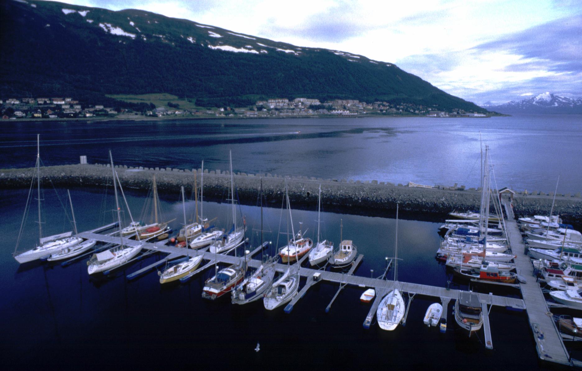
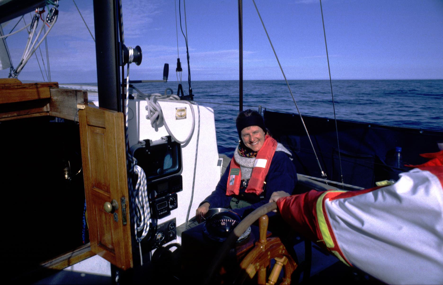
This story begins on the 15th July, 2000, in Tromsø. I had come there to sign on as a crew member for a voyage to Spitsbergen on board a 36-foot sailing vessel, the Havsul of Tromsø. I met the people with whom I was to spend the next weeks, Arne, Karl-Peter, Barbara and Jos, and we set out. We agreed to work in four-hour shifts: four hours on duty, four hours of rest, which became known as a "day" for the rest of the trip. Once we had cleared the Norwegian coast, we set a northerly course for Bear Island (74°21'N 19°07'E), 310 nautical miles north of Tromsø. |
|
|
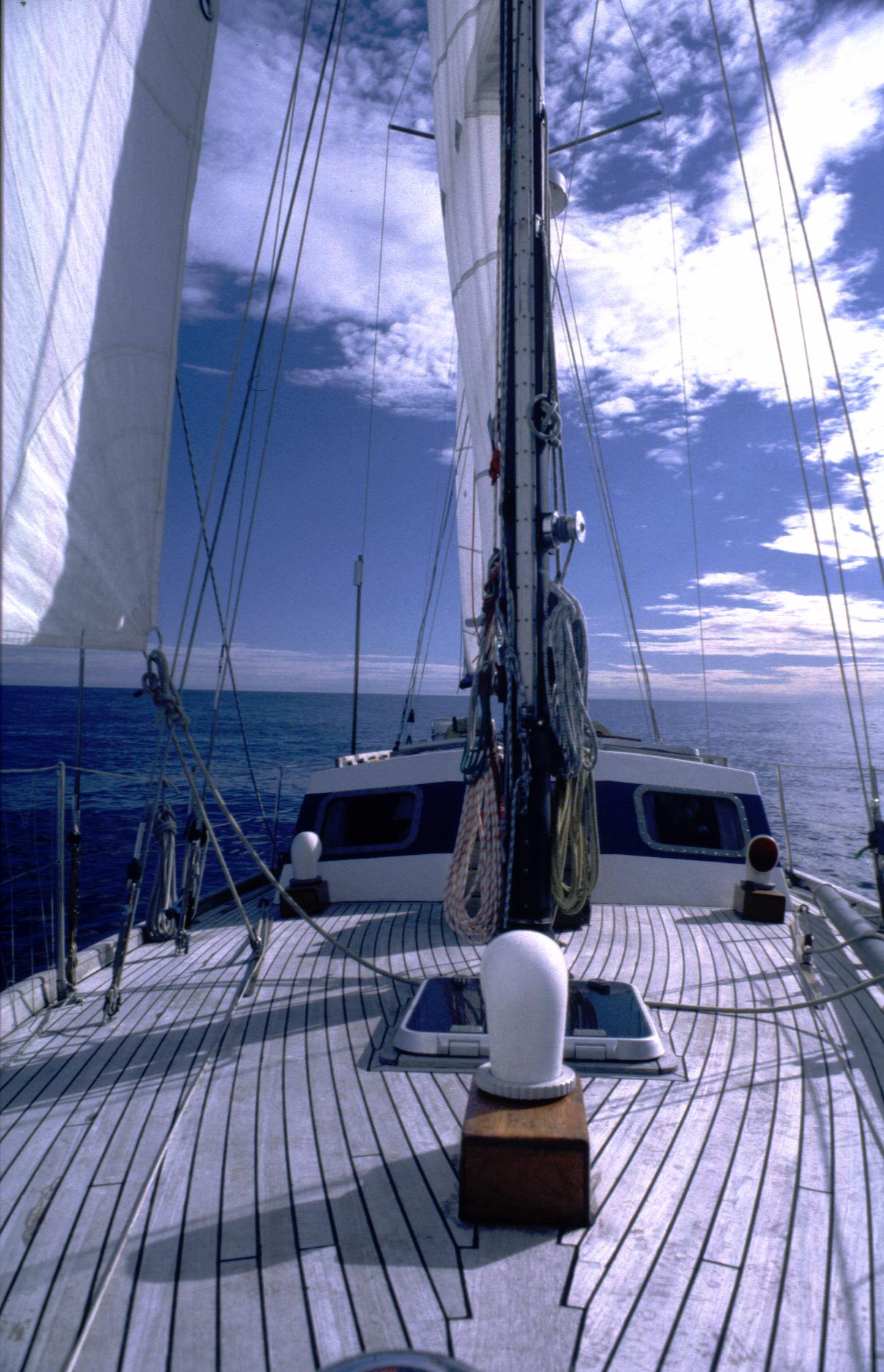
After the first two days at sea, which for some reason always seem long, the sense of time is lost, and in these waters where the sun circles above the horizon in 24 hour cycles during the summer, the biological clock no longer tells the time or tells one day from another. Time flows by and yet the time sailed doesn't seem to accumulate. It's the experience of sailing that I like. It would have made little difference had the crossing have taken three days or two weeks. With fair winds, however, we estimated that it would take five days. The sailing conditions were fair during most of it with mainly northeastern winds. Fog was frequent, as it is in the Arctic Ocean, but it is often only a few meters thick. The blue sky is usually visible straight overhead and a spell of sun may not be far away. Whales of several kinds were a common sight. |
|
|
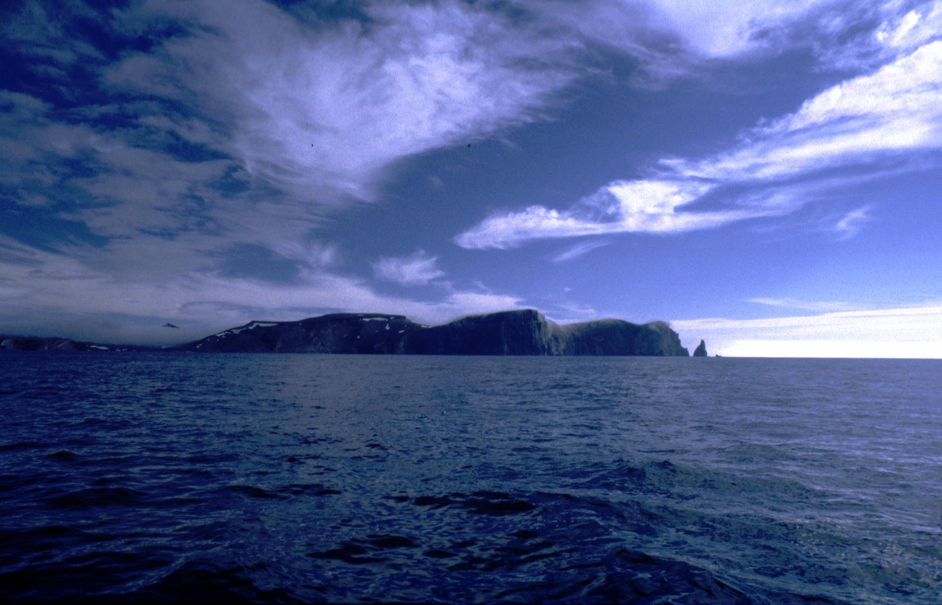
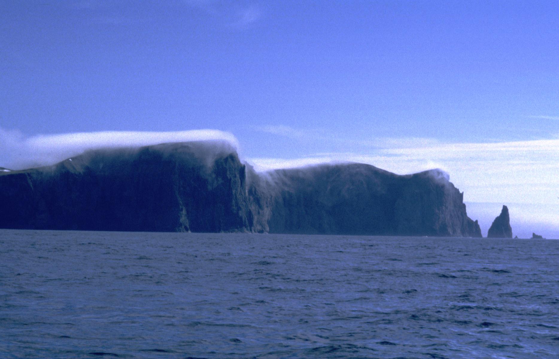
We first spotted Bear Island on the northern horizon 76 hours after departure. Its mountains could be seen above the sea fog and rising into a low cloud cover. The ocean and sky were grey and dull, and the temperature had dropped to four degrees centigrade. It was the exact same view that I had seen here some years earlier on a similar voyage, and probably seen by many others who have been in these waters. On my last voyage, however, my crewmates then and I had to make an early turn back at this island. It was encouraging to see the island this time, knowing that we would soon sail past the point where I last turned. |
|
We were going east of the island, which again became lost in fog. Strong currents near the island reduced our progress to a crawl, so we turned back, sailed round its southern cape and along its western coast. There the clouds dissolved, the wind picked up, and later that day we sailed faster than we had before, making up for the time lost going on the wrong side of the island. It was soon out of sight. |
|
|
|
|
| [Steinar Midtskogen] | [index][next] | [Latīnē] |
![[Harbour]](../00_2/med/1123.jpg)
![[Barents Sea]](../00_2/med/1127.jpg)
![[Barbara]](../00_2/med/1126.jpg)
![[Bear Island]](../00_2/med/1129.jpg)
![[Bear Island]](../00_2/med/1130.jpg)
![[Bear Island]](../00_2/med/1131.jpg)
![[Bear Island]](../00_2/med/1135.jpg)
![[Bear Island]](mpegbarents.jpg)